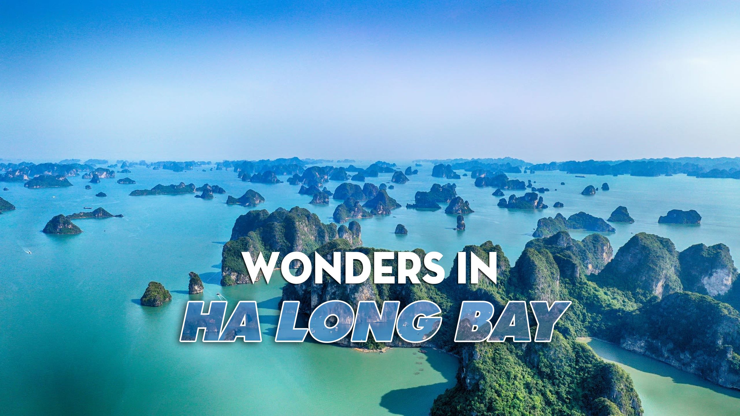

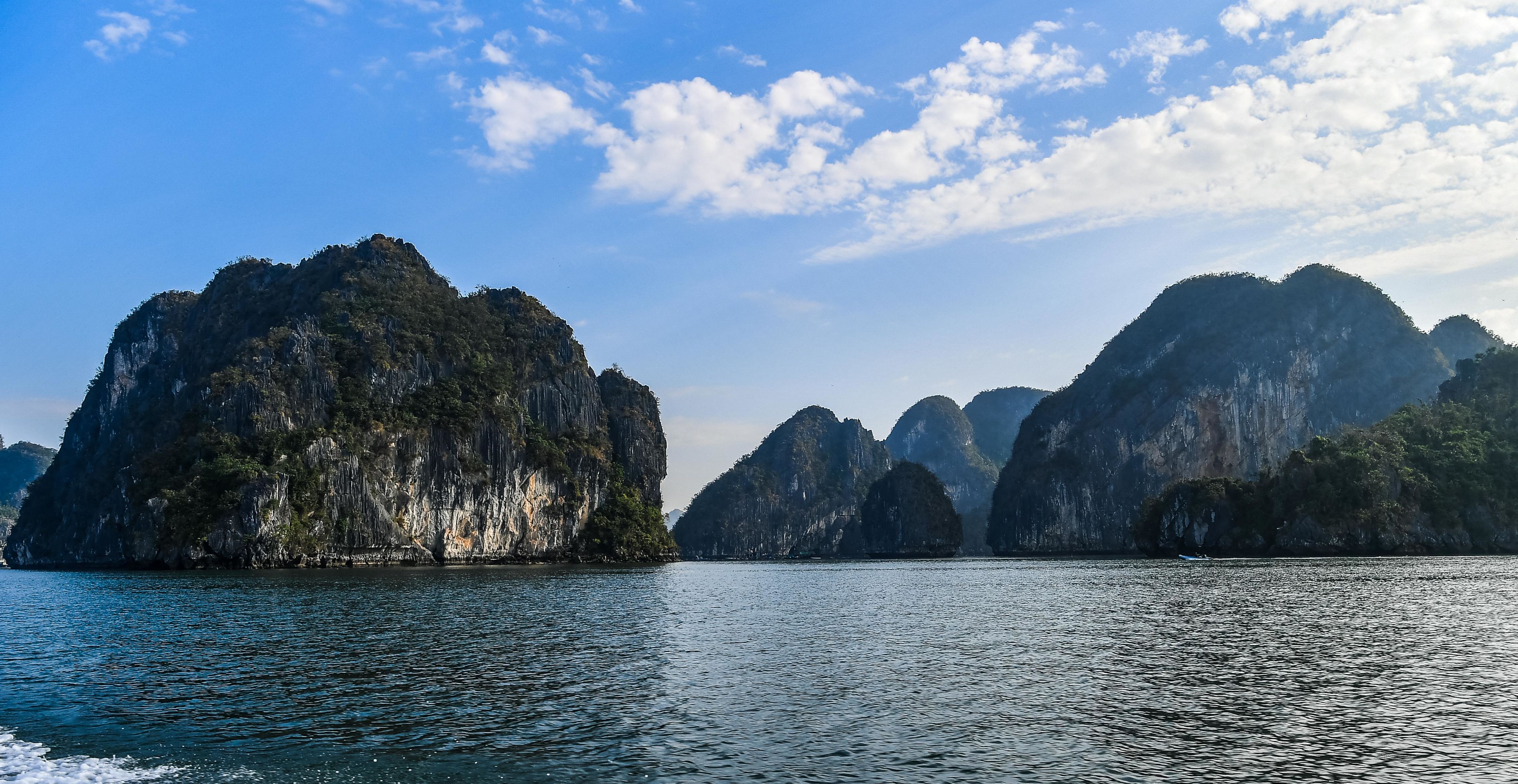
Known for its stunning natural landscape, Ha Long Bay is also exquisitely charming as the weather changes throughout the seasons. Mountains, beaches and caves in Ha Long are the most outstanding features, luring many visitors to come back after their first visits.
Ha Long Bay has nearly 2,000 islands of various sizes. Within the 1,553-square-kilometre area designated as a national heritage site by the Ministry of Culture and Information in 1962, there are 1,969 islands, 980 of which are named. Within the area recognised as a World Heritage site by UNESCO, which spans 434 square kilometres, there are 775 islands.
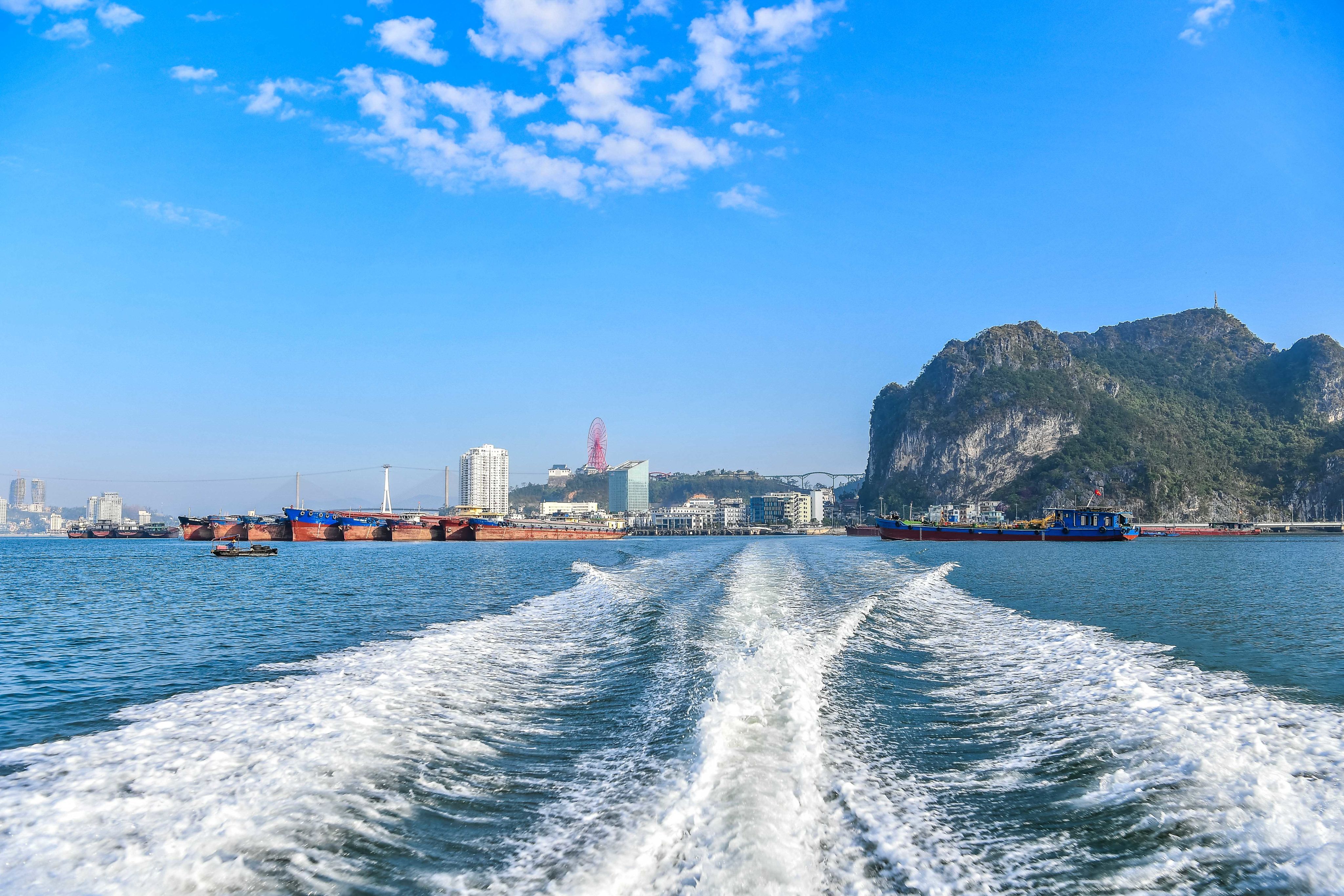
Ha Long Bay is located in northeastern Vietnam, under the administrative jurisdiction of Quang Ninh Province. Ha Long Bay was formed by changes in the climate throughout history and the Earth’s tectonic movements.
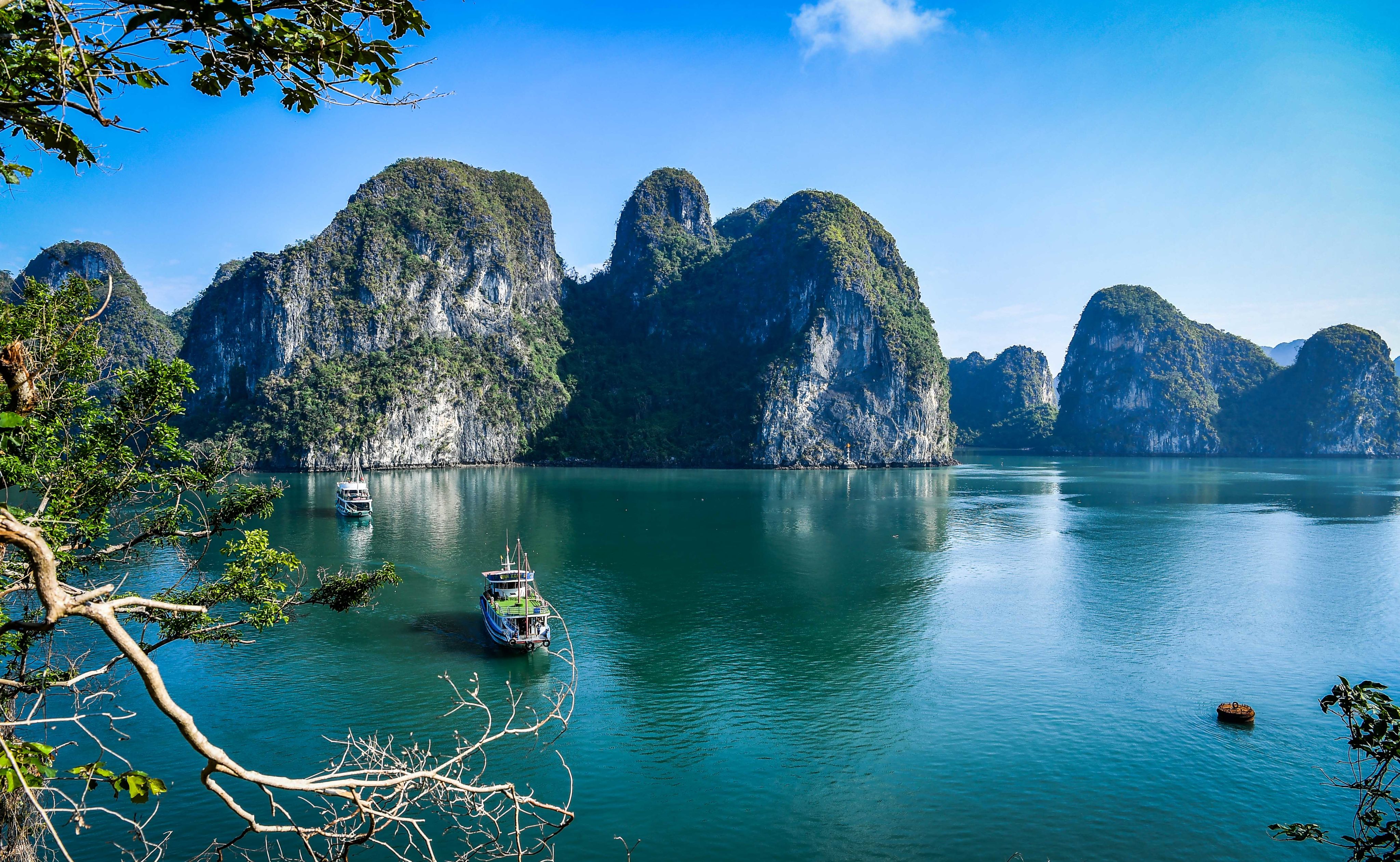
The beauty of Ha Long Bay is created by three elements: limestone, water and sky.


Magnificent castles on the sea
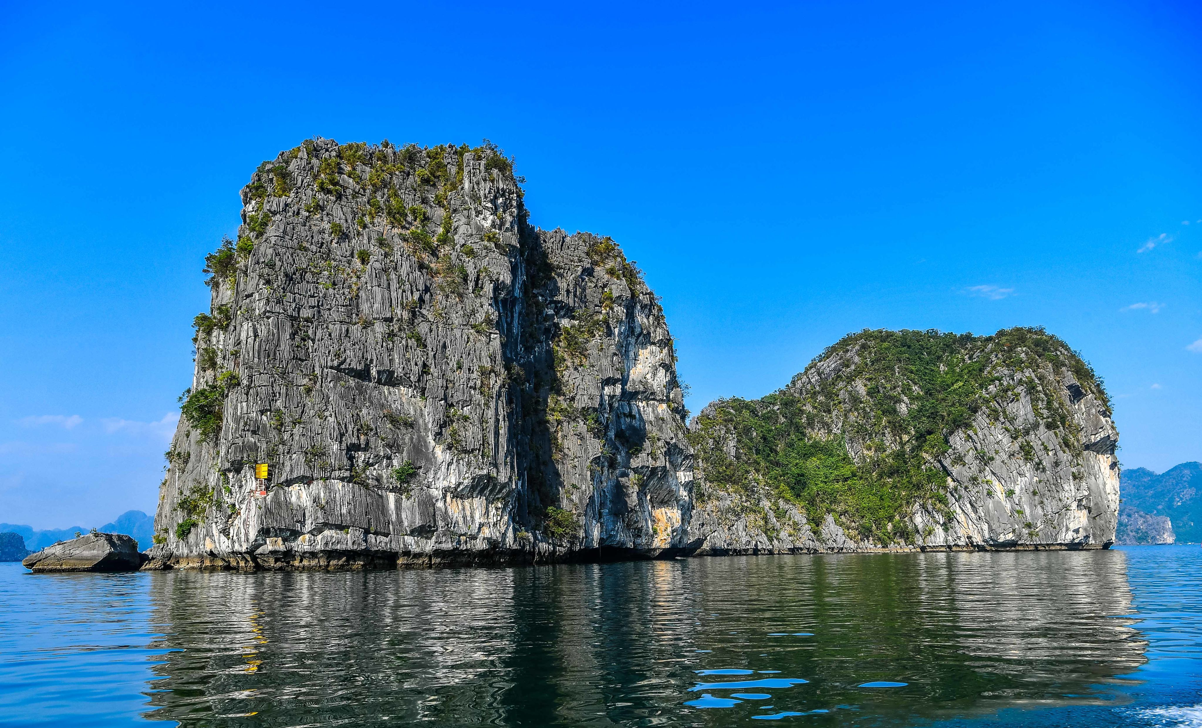
The beauty of Ha Long Bay is created by three elements: limestone, water and sky. The system of limestone islands in Ha Long Bay takes on countless shapes and forms that blend with the sky and sea to create vistas like an ink-wash painting. Inside the large limestone islands are captivating caves of beautiful and strange formations.
The islands are karst formations that developed under humid, tropical conditions. The entire Ha Long Bay area represents a karst landscape that has evolved over millions of years, featuring eroded karst towers and pyramidal peaks, creating a uniquely striking scenic beauty that is unparalleled worldwide.
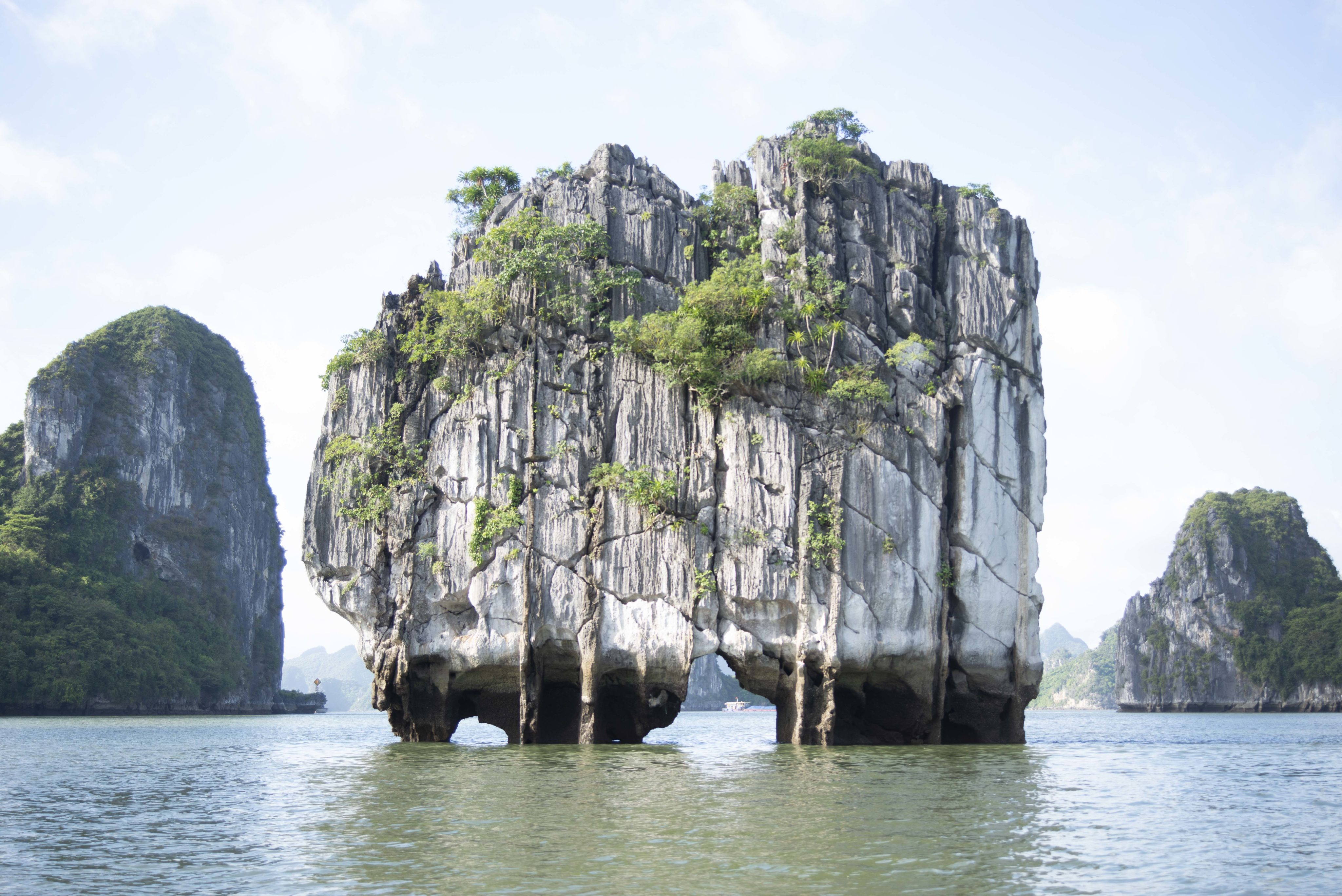
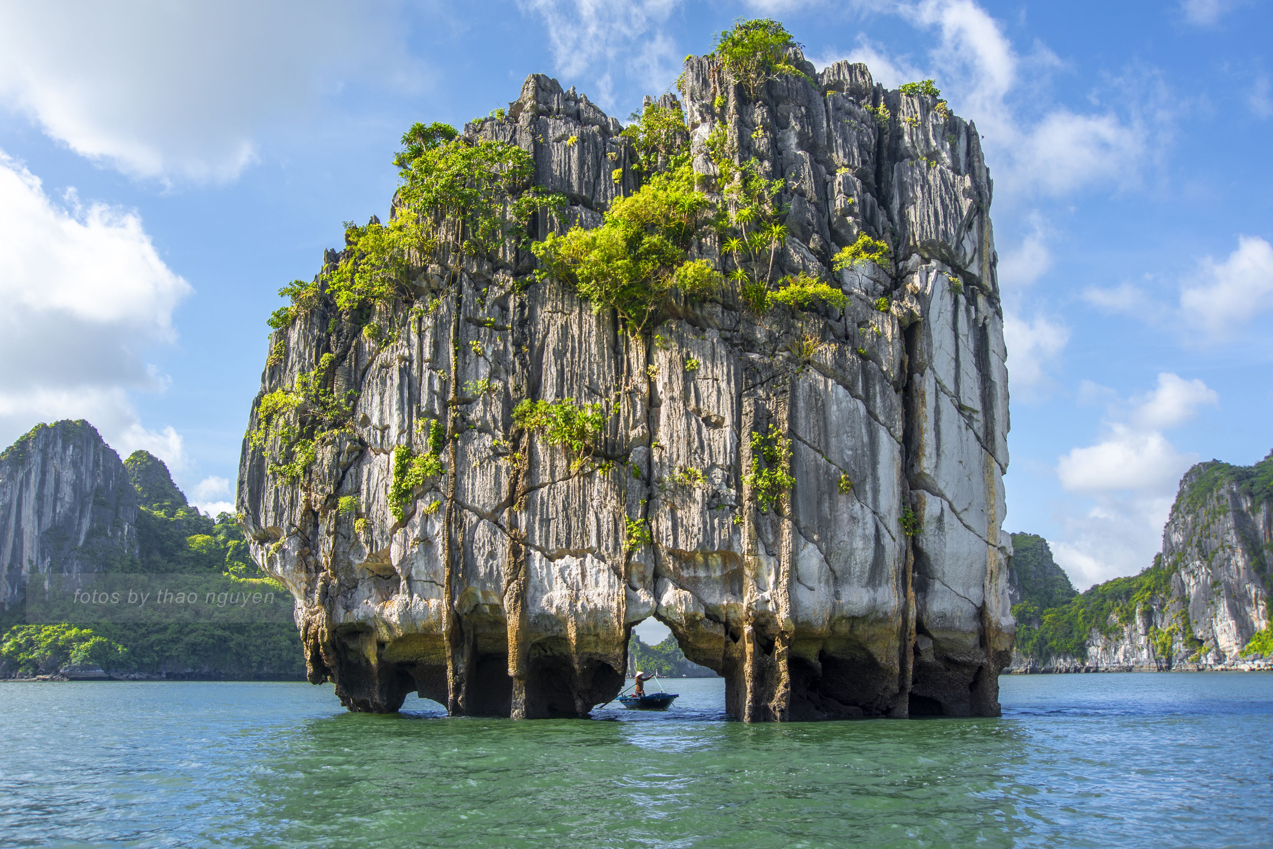
The geological history of Ha Long Bay has gone through various ancient geographical conditions, including multiple mountain formations, marine regressions, submergence, and marine transgressions. These changes over millions of years have created limestone islands with thousands of peculiar shapes, which local people have named and which have become the most famous attractions in Ha Long Bay.
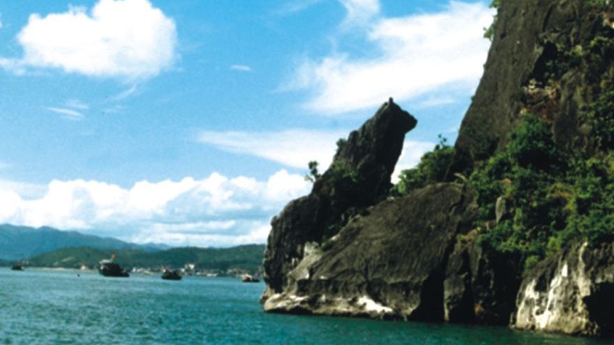
Ga Choi Island / Trong Mai Islet
Ga Choi (Fighting Cocks) Islet, also known as Trong Mai (Cock and Hen) Islet, is located in the southwest of the bay, approximately 5 kilometres from the Bai Chay tourist port. This cluster of islands is shaped like a pair of chickens — one cock and one hen — about 10 metres high, with narrow bases in a seemingly precarious position. Trong Mai Island has become the symbol within Ha Long Bay’s logo and appears in Vietnamese tourism guidebooks.
From a distance, Ga Choi Islet looks like two giant muscular chickens fighting each other on the vast waves. Each is about 12 metres tall, standing in an unsteady pose, with tiny feet supporting massive bodies that seem as though they could topple over with just one strong wave.
Yet hundreds of millions of years have passed, and Ga Choi Islet still stands there, its very imbalance creating an attraction for tourists.


Dinh Huong/Lu Huong (Incense Burner) Islet

While Ga Choi Island is the symbol on Ha Long Bay’s logo, Dinh Huong Islet is featured on Vietnam’s 200,000 dong banknote.
Dinh Huong Islet is located on tourist routes number 1 and 5 in Ha Long Bay, approximately 2.5 kilometres from Tuan Chau International Port, to the southwest of Dau Go Cave and in the middle of the shipping channel near the Ba Hang Cave area.
From afar, one can see Dinh Huong Islet towering in the middle of the sea. Dinh Huong Islet is a majestic rock mountain lying on four thin rocks blocking the path. The rock’s shape is like a giant incense burner in the middle of the vast sea.
The image of Dinh Huong Islet has been promoted in many places, and some travel companies even have posters and stickers with this place as a proud symbol of Ha Long Bay.
Con Coc Islet

About 12 km southeast of Bai Chay tourist port, Con Coc (Toad) Islet is also one of the famous tourist attractions in Ha Long Bay. This rocky mountain looks like a toad sitting and waiting for rain to fall in the middle of the sea.
This is one of the smallest limestone islands in Ha Long Bay, with a height of only 9 meters. Due to the limited area, visitors can only see the islet from afar when travelling by boat and cannot set foot directly on it.
Con Coc Islet reminds us of the image of a toad calling for rain in a Vietnamese folk tale.
With the shape of a toad sitting on a 9-metre-high limestone mountain, Con Coc Islet has become a typical symbol of Ha Long Bay and is also a stop that cannot be missed when going there.
Cho Da Islet

Cho Da (Stone Dog) Islet is a small 8-metre high rock located in an area which hosts famous stops of Ha Long Bay, such as Thien Cung Cave - Dau Go Cave - Ti Top Island. It takes around 10 minutes to travel from Thien Cung Cave to Cho Da Islet.
The reason for its name, Cho Da Islet, is because the island resembles a dog sitting with its back to the sea. It is like the symbol of a guardian for the safety of tourists' trips.
The position of Cho Da Islet is seen as a dog sitting with its back to the sea. From Dau Go Cave, go around the rocky island and look up at a height of about 8 m, visitors will see the Cho Da Islet with their own eyes.
Nowadays, most of the day tours and overnight tours on Ha Long Bay pass through this beautiful islet. From the cruise, visitors can easily see Cho Da Islet.
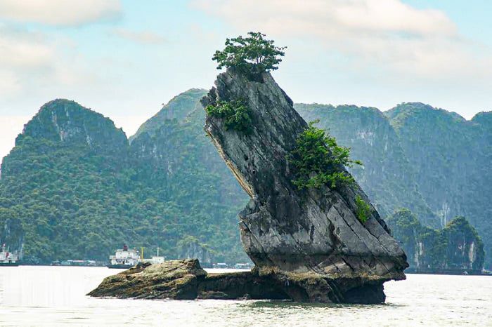
Yen Ngua Islet

Located in the centre of Ha Long Bay, about 14km from Bai Chay tourist port, Yen Ngua (Horse Saddle) Islet is a rocky mountain with a unique shape carved by Mother Nature. The islet is about 10m high, consisting of two stone piers, one large and one smaller, which are linked together to form the shape of a horse saddle.
In particular, there is a hollow space below this saddle, creating a path that a medium-sized yacht can pass through.
Although this islet is not currently a main attraction en route to tour Ha Long Bay, some overnight cruises still pass this venue during their journey.
Oan Island

Oan (Truncated-cone) Island is located very close to the shore, only 300m from Bai Tho (Poem) Mountain, about 5km east of the tourist port. It can be seen from the shore with the eye in good weather conditions. Oan Island is 22m high, with a full, balanced shape. It is named ‘Oan’ by locals because its shape is like an ‘oan’ - a truncated-cone-shaped cake.
This island is 22m high and has a normal shape, but French tourists love it because this is the place where, in 1992, the famous French actress Catherine Deneuve came to film some scenes in the movie L’indochine (Indochina) produced by Paradis Film.
In a small corner of the island, the scenes built for the movie are still preserved, such as the stone road to the sea called the slave wharf and the house of the prison camp where the couple painfully broke up. Sitting at the Bien Mo floating restaurant, you can see this island very closely.
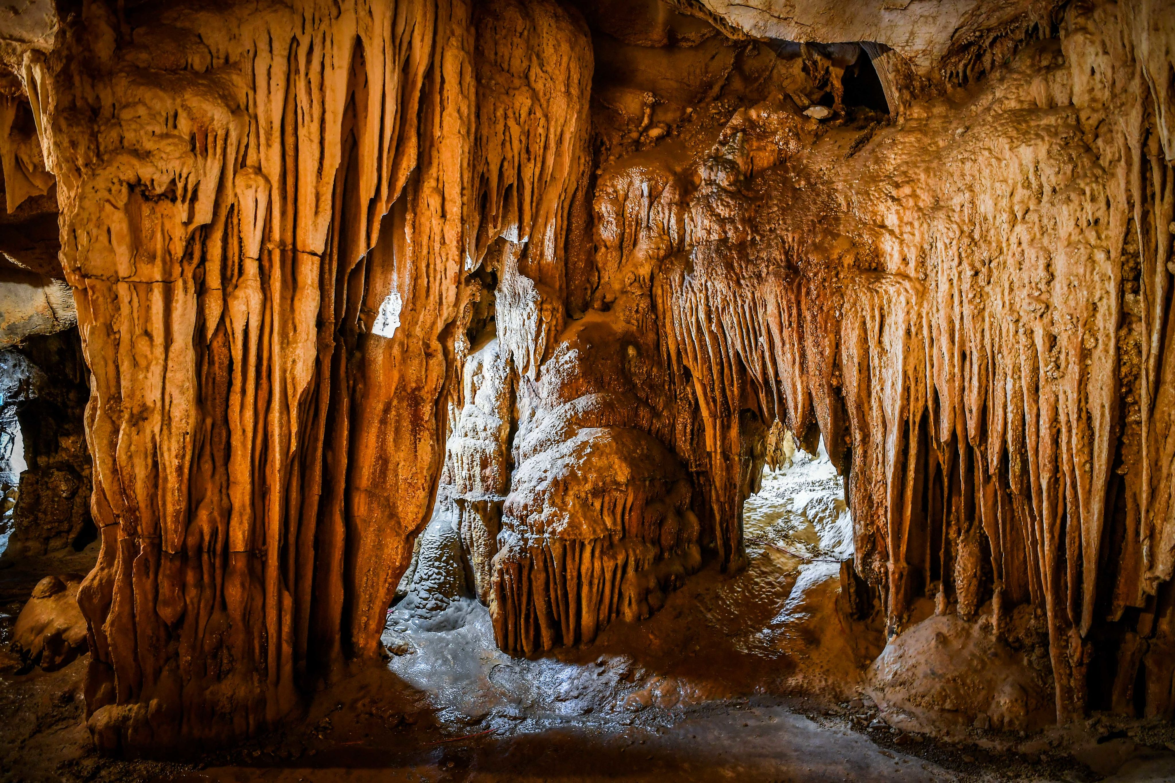
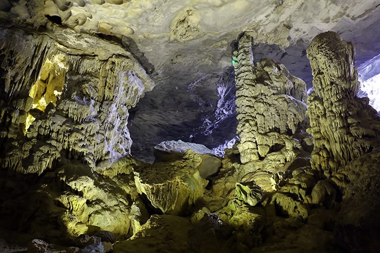
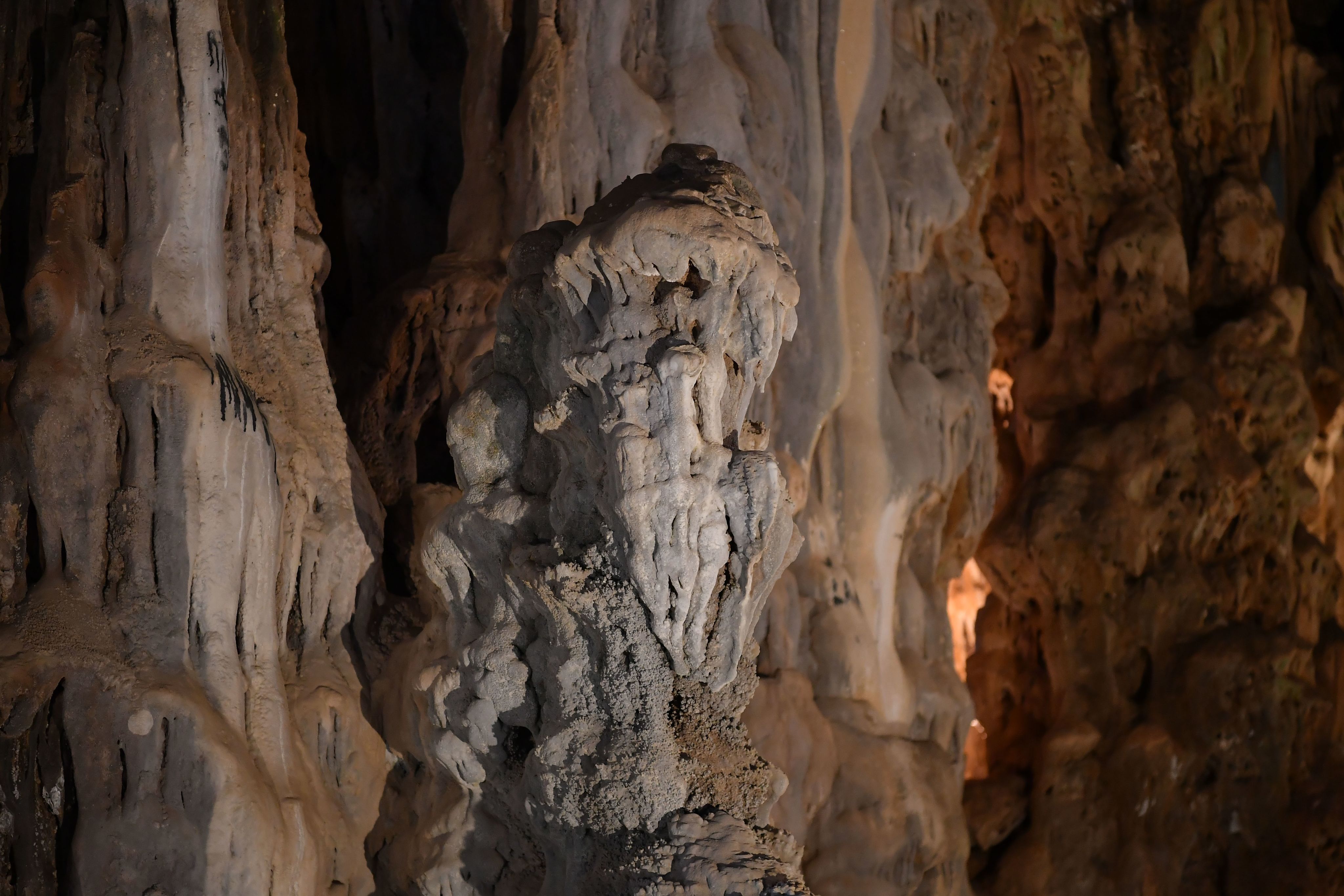
Splendid “palaces” in the heart of the mountain
The underground Karst terrain in Ha Long is a system of diverse caves in the bay, divided into three main groups.
Group 1 is the relics of ancient underground caves, typically Sung Sot Cave, Tam Cung Cave, Lau Dai Cave, Thien Cung Cave, Dau Go Cave, Thien Long Cave, etc.
Group 2 is the Karst caves, typically Trinh Nu Cave, Bo Nau Cave, Tien Ong Cave, Trong Cave, etc.
Group 3 is the system of “sea frog jaws”, typically the three connected caves in the Ba Ham Lake cluster, Luon Cave, Ba Hang Cave, etc.

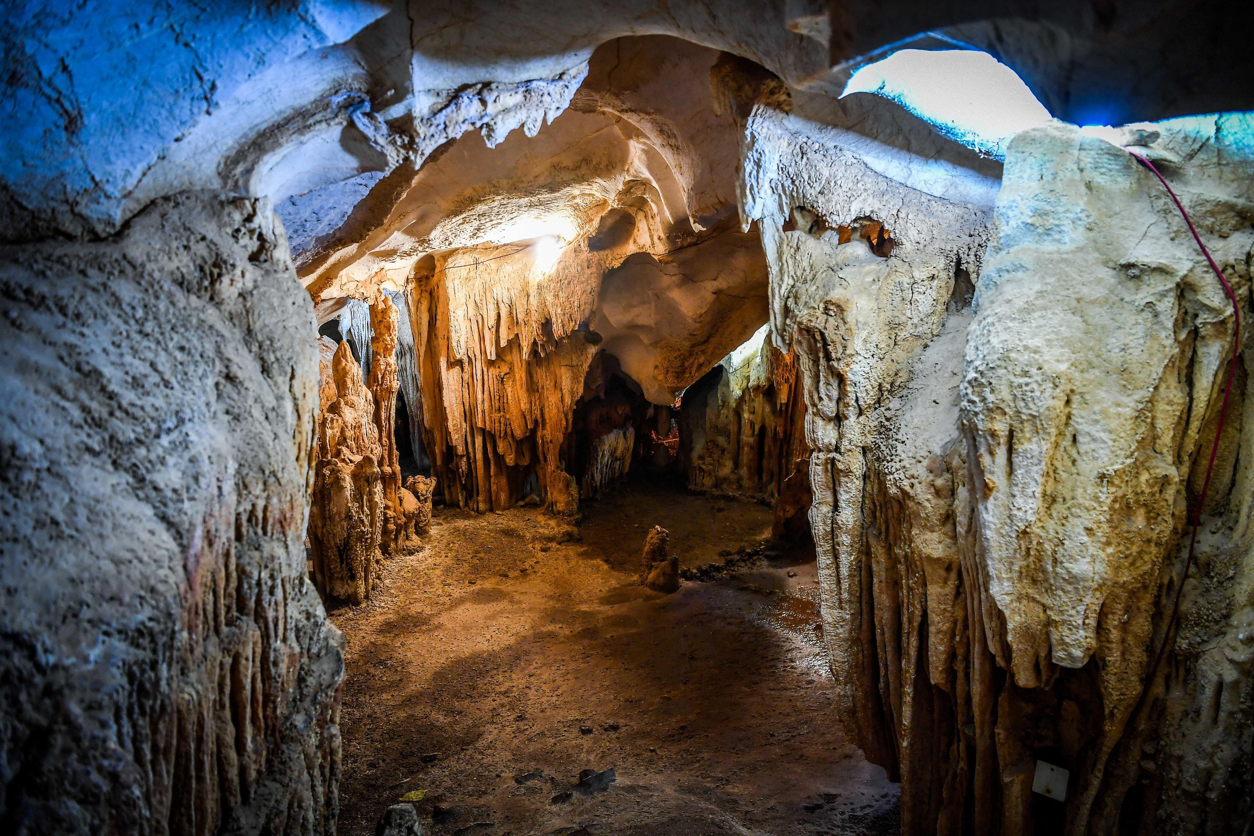

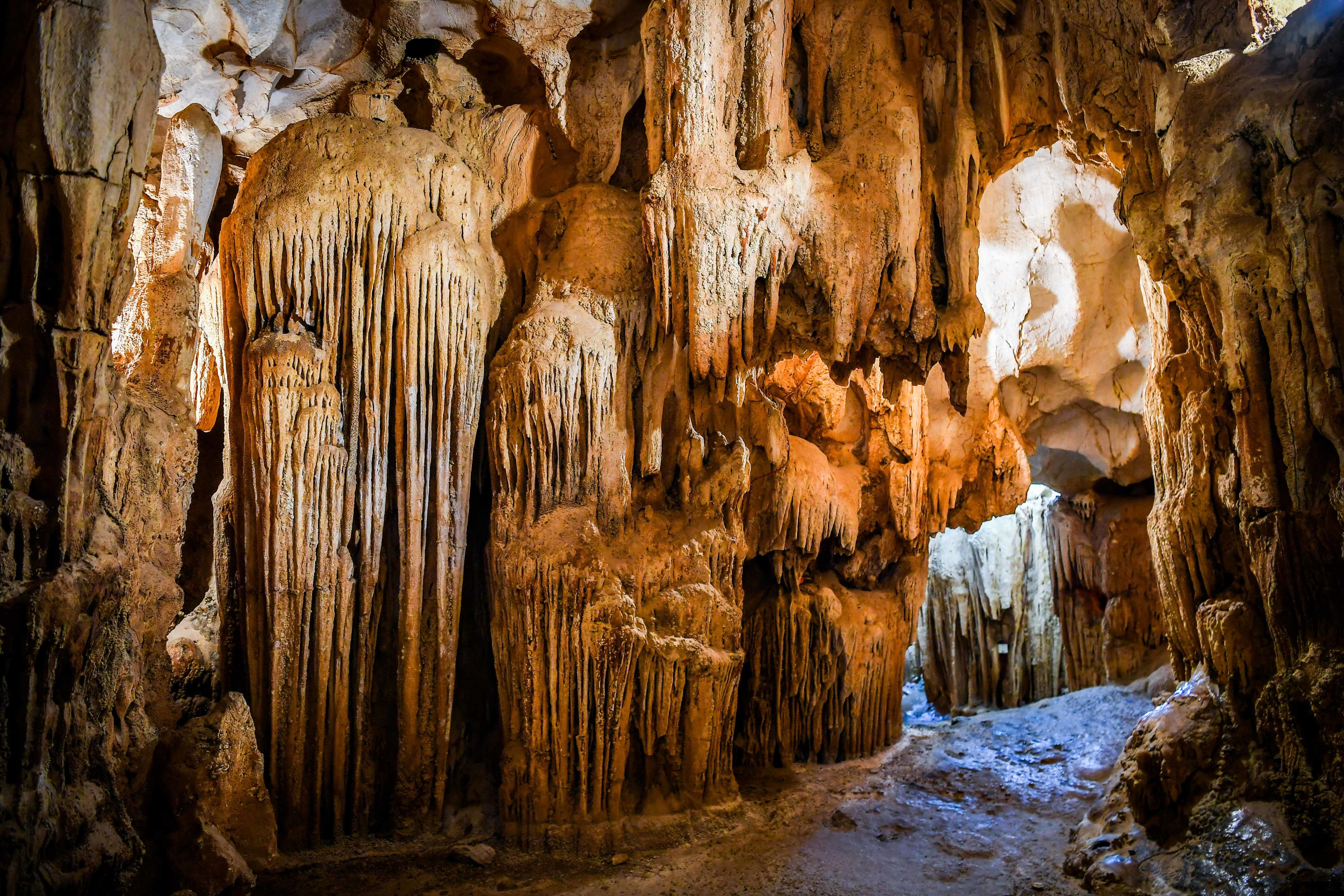


Dau Go Cave

Dau Go Cave is a limestone cave belonging to the Ha Long Bay scenic complex. This cave is about 3km from Tuan Chau Island and about 6km from the Bai Chay tourist area. Visitors coming here can feel the beauty that is both wild and ancient, with many natural stalagmites of strange shapes.
Dau Go Cave is located at an altitude of 27m above sea level, with an area of about 5,000 m2 and a cave entrance 17m wide and 12m high. Scientists believe the cave was formed about 2 million years ago, at the same time as Thien Cung Cave, only 300m away. Compared to other caves in the bay, Dau Go Cave is more favoured by nature with a rich flora and fauna system and massive, majestic architecture.
Dau Go Cave has three stories passed down by word of mouth to explain its name.
The first legend said that in the war against the Mongols in the 13th century, Tran Hung Dao, the commander-in-chief, ordered the planting of stakes to destroy the enemy's ships. Thanks to this smart strategy, a resounding victory was achieved, helping to protect the country’s borders. Later, many wooden stakes were left in the cave, so the locals named it Dau Go Cave, a mispronunciation of the word “wood hiding.”
The second legend explains that in front of Dau Go Cave is a series of Dau Go islands in the shape of a bow. This creates a sheltered area, helping fishermen to shelter from storms during fishing season. During the fishermen's stay here, they repaired their boats and left behind many pieces of wood. The name Dau Go was also formed from this incident.
In the third legend, people also passed on another explanation.
That is because Dau Go Island, from afar, looks like a large log with two holes at both ends to thread ropes. Based on this special feature, people named the cave Dau Go Cave.
Merveille de Monde magazine - a French travel magazine, published an article mentioning Dau Go Cave in 1938, honouring this cave as Grotte des Merveilles (Cave of Wonders).
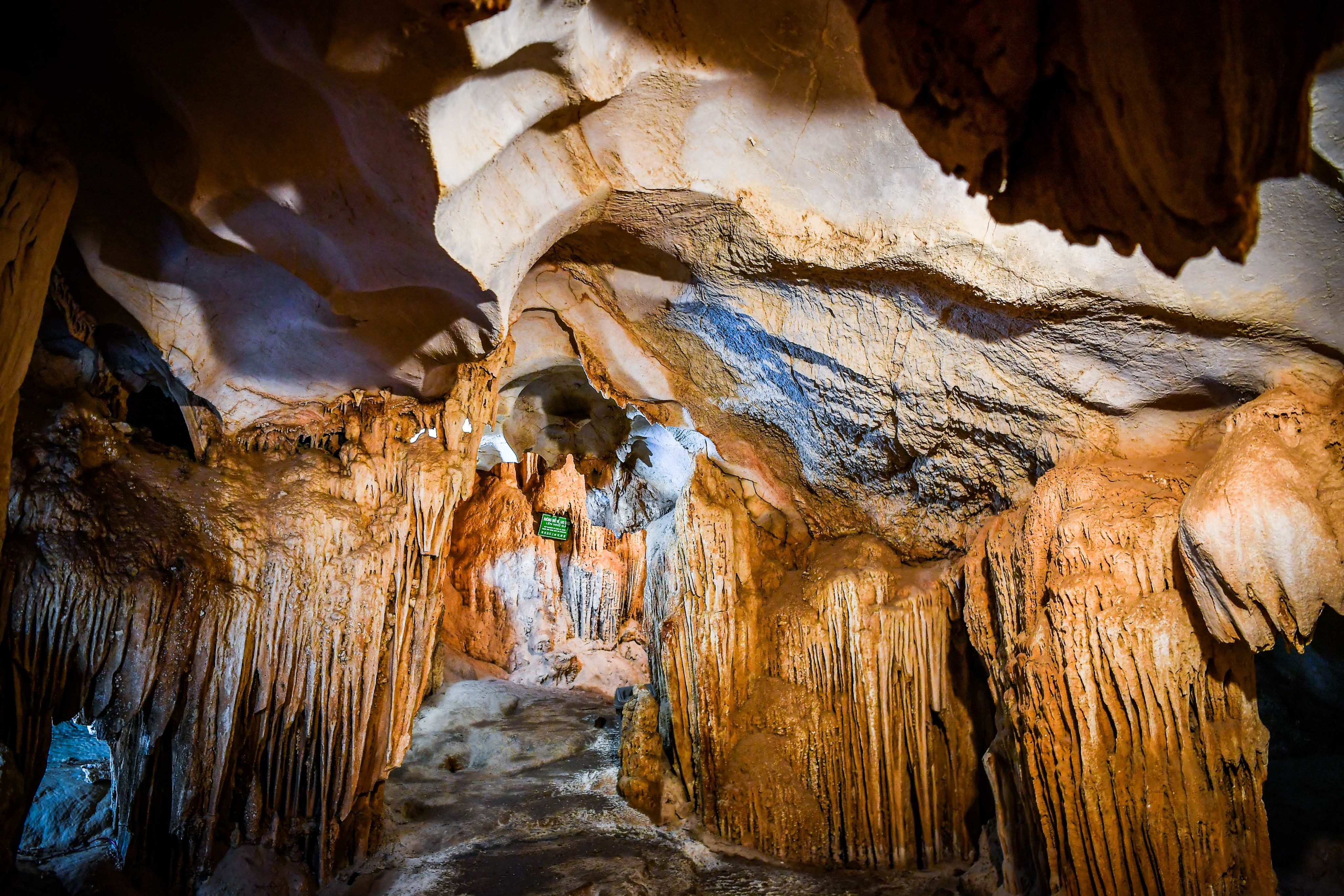
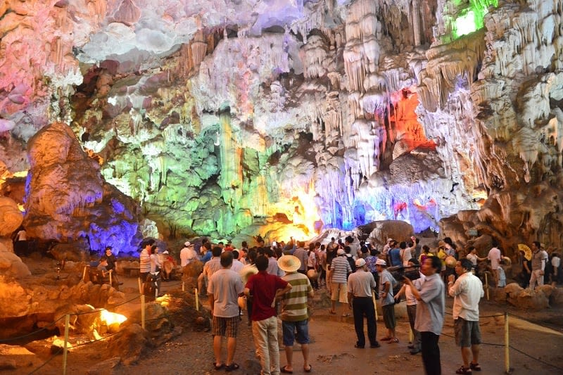
Thien Cung Cave
Thien Cung Cave is one of Ha Long Bay's largest and most beautiful caves. It is nestled on the Dau Go Island range, southwest of Ha Long Bay, about 4 km from the tourist port. The cave entrance is situated approximately 25 metres above sea level. Covering an area of nearly 10,000 square metres, the cave boasts a complex structure adorned with uniquely shaped stalactites and stalagmites. Thien Cung Cave is often likened to a grand and magnificent temple.
The cave is also a site of the Soi Nhu culture (the culture of prehistoric humans). At the entrance and on the cave's floor, archaeologists discovered sediment layers of Melania snail shells, indicating the existence of carbonate freshwater snails. Additionally, stone tools have been found on the cave walls.
On May 1, 1998, Thien Cung Cave officially opened to tourists. It was the first cave in Ha Long Bay to undergo large-scale renovations.
Bo Nau Cave

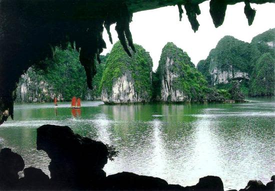
A famous photo taken in 1958 by photographer Nguyen Duy Kien from inside Bo Nau Cave.
A famous photo taken in 1958 by photographer Nguyen Duy Kien from inside Bo Nau Cave.
Bo Nau Cave is part of the second tourism route in Ha Long Bay, located about 13 km southeast of the Tuan Chau International Port. It is nestled within Bo Nau Island, surrounded by other notable attractions such as Sung Sot Cave, Luon Cave, Titov Island, Trong Cave, and Trinh Nu Cave.
Bo Nau is a limestone karst cave. According to French records and early 20th-century Vietnamese publications, it is one of the most picturesque sites in Ha Long Bay.
The entrance to the cave features a small sandy beach accessible only by kayak or small boat, as larger vessels cannot enter.
The cave’s entrance has a dome-like shape resembling an inverted seashell, creating a secluded space that feels like the ceiling of a theatre adorned with soft, willow-like stalactites.


Me Cung Cave

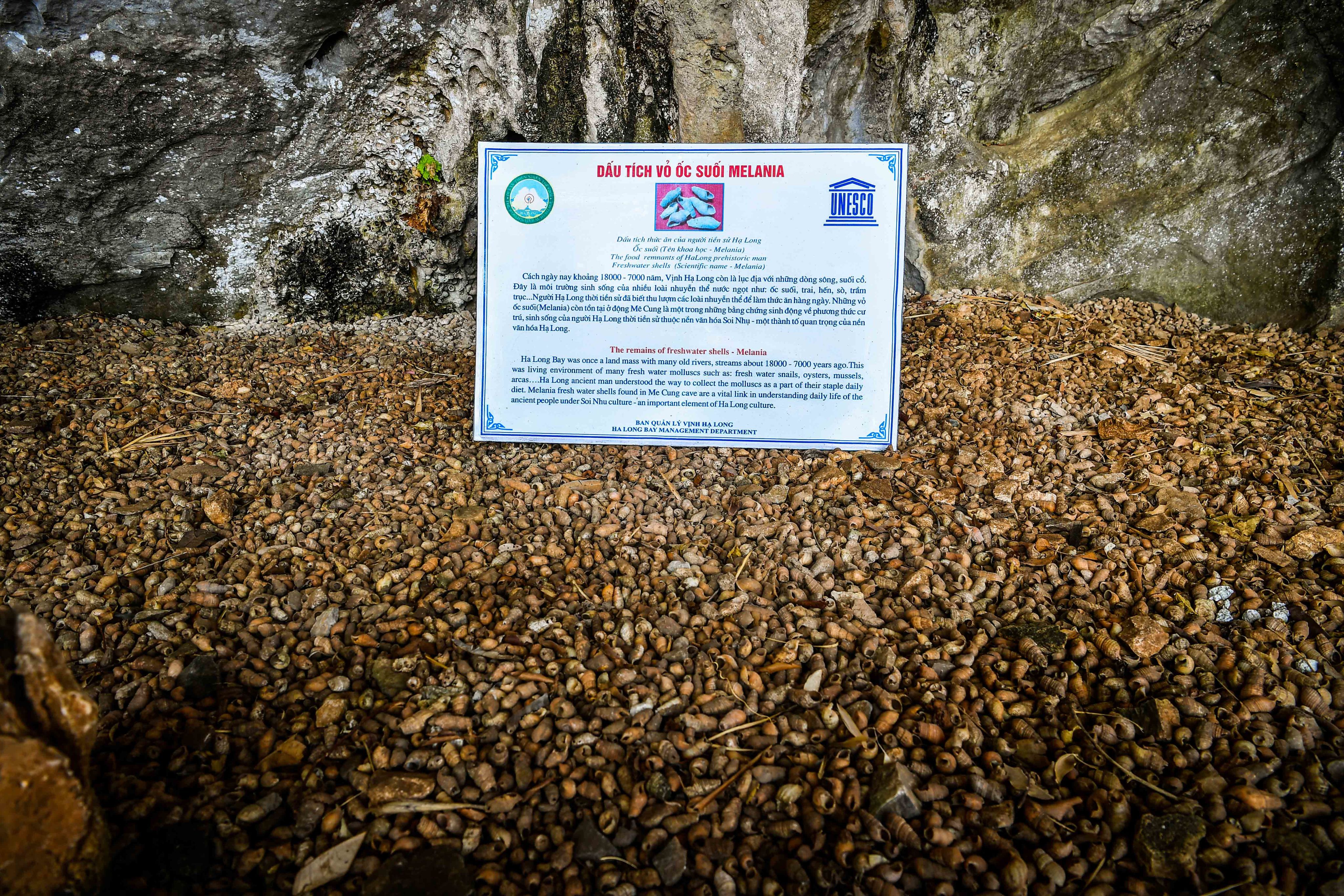
Snail shells at the entrance of the Me Cung Cave
Snail shells at the entrance of the Me Cung Cave
Me Cung Cave is located in the strictly protected area of Ha Long Bay. Situated 25 metres above sea level on Lom Bo Island, it lies about 2km southwest of Titov Island.
The cave has a highly intricate structure, featuring multiple levels, compartments, and winding corridors that stretch across a rock roof with a passageway over 100 metres long, gradually rising toward the west.
The entrance to Me Cung Cave faces east and spans a flat area of 40 square meters. From afar, the cave’s entrance resembles a house roof embedded into the island’s slope. It is airy, dry, and cool, leading to a system of small, zigzagging, and highly secluded inner caves.
Archaeologists have identified Me Cung Cave as one of the earliest sites of the Ha Long culture, dating back 10,000–7,000 years. The most prominent relics found at the cave’s entrance are Melania snail shells, a species that lives in streams. The ground on the right side of the path leading to the cave still contains many mollusk shells. Today, the sediment layers at the cave entrance still include well-preserved cemented remains of both freshwater and mountain snails. These sediment layers initially formed cultural strata 60–150 cm thick. Apart from snail shells, some mussel and clam shells have also been found. The Ha Long Bay Management Board has collected and preserved fossilised and semi-fossilised animal bones from Me Cung Cave.
Sung Sot Cave

Sung Sot Cave is located on Bo Hon Island, in the heart of Ha Long Bay, Bai Chay Ward, Quang Ninh Province. In 1901, a French scientist visited the cave and named it "Grotte de la Surprise" – the cave of surprises.
The cave is stunningly beautiful, with stalactites and stalagmites forming shapes resembling wild chickens, frogs, dragons, waterfalls, and many other forms, creating a fairy-tale-like world.
In 2012, Sung Sot Cave was ranked among the top 10 most beautiful caves in the world by the Association of Tour Operators and Travel Agents of the Czech Republic.
Tien Ong Cave
Stalagmite resembling an old man in Tien Ong Cave
Stalagmite resembling an old man in Tien Ong Cave
Tien Ong Cave is situated in the heart of Cai Tai Islet (Hang Trai Island area), about 18 kilometres from Tuan Chau International Tourist Port and 16.5 kilometres from Ha Long. The cave was formerly known as Ren or Duc Cave. It was named Tien Ong because of a stalagmite resembling an old man with a kind face, long hair and beard, much like a fairy elder.
Unlike other caves in Ha Long Bay showcasing natural wonders, Tien Ong Cave is a living witness to the ancient Vietnamese culture in Ha Long. It features an archaeological exhibit of prehistoric artefacts, proving that human life existed offshore thousands of years ago. The cave's entrance is wide and arch-shaped, about 13 metres high, facing northwest. Located around 5 metres above sea level, Tien Ong Cave is divided into two sections separated by a large stalactite. After passing through the outer part, filled with mollusk sediment—remnants of ancient life—visitors can explore six inner chambers adorned with shimmering stalactites. The largest chamber is 70 metres long, 43 metres wide, and 10 metres high.
Unparalleled Beaches
Scattered among the bay’s rocky islands are numerous pristine, stunning beaches. While not many have been developed due to transportation and infrastructure limitations, these beaches remain a major draw for tourists thanks to their untouched, captivating beauty.

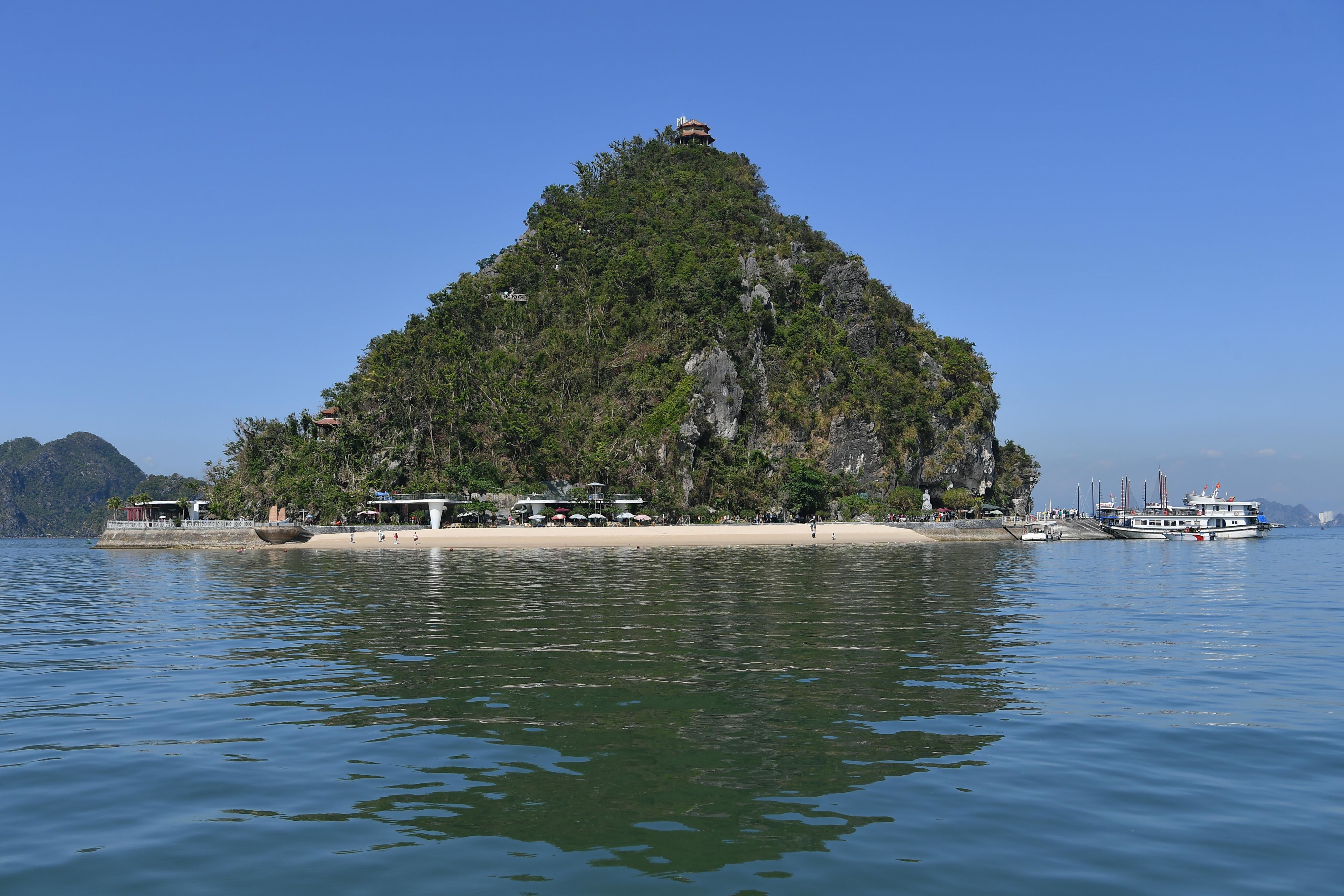
Titop Beach

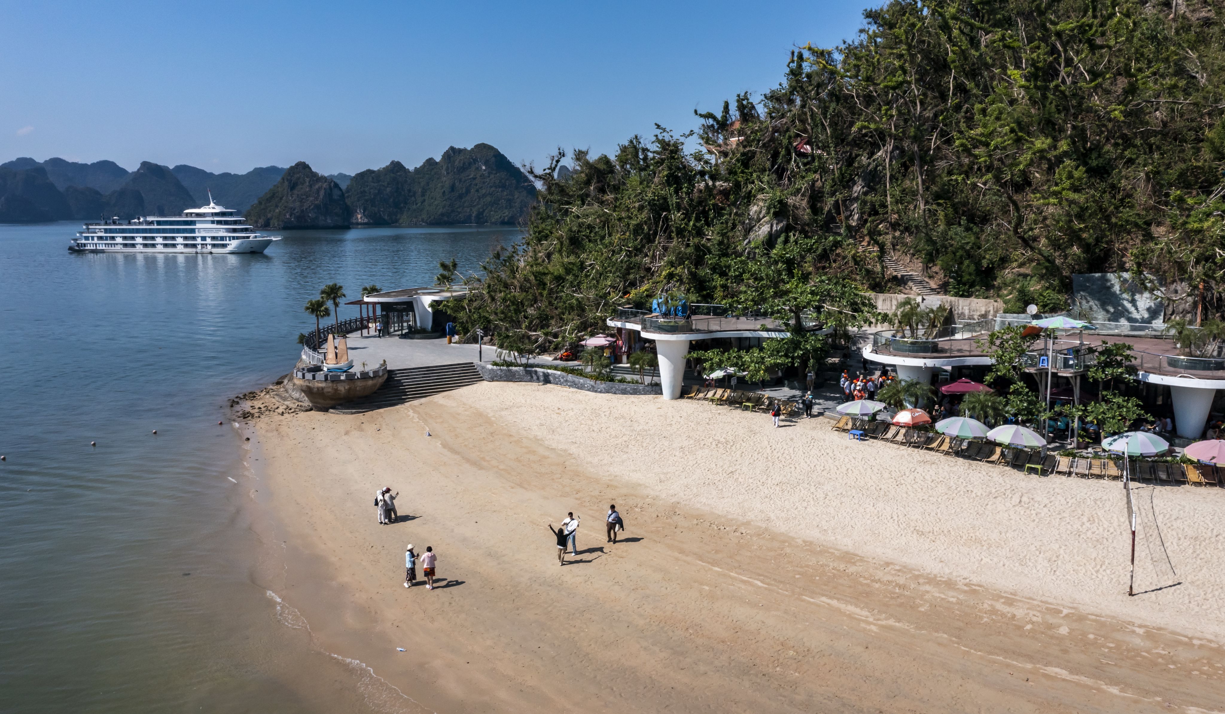
Titop Beach is one of the most famous beaches in Ha Long Bay and is considered one of its most beautiful. The island was named Titop in 1962 when President Ho Chi Minh and Soviet astronaut German Titov visited it. The picturesque island was later named in honour of this memorable event.
As a small and poetic beach, Ti Top features an attraction that few other beaches in Ha Long have. Located on an island with no hotels or restaurants around, Ti Top Beach has a peaceful and quiet sea space. Ti Top Island is located on the most popular tourist route at present — on the second sightseeing route of Ha Long Bay, with Sung Sot Cave, Ti Top Island, and Luon Cave.
Soi Sim Beach

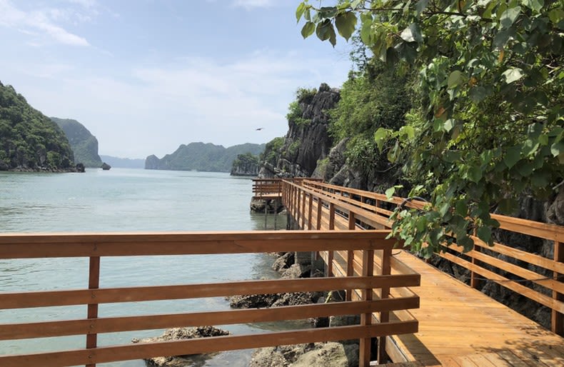
The wooden walkway system on Soi Sim Island.
The wooden walkway system on Soi Sim Island.
Soi Sim Beach is located on Soi Sim Island, about 12km from Bai Chay Tourist Port, only 700m from Ti Top Island. Soi Sim Island is one of the rare islands that still retains its pristine beauty with extremely rich flora and fauna. Soi Sim possesses a primeval forest on a special geological structure. The flora and fauna here are very diverse and include many endemic species which are valuable and characteristic of the Ha Long Bay ecosystem.
Soi Sim Island received its name due to the many Sim (rose myrtle) trees growing on the island. Every year, the rose myrtle flowers bloom to create a romantic and beautiful space.
Soi Sim Beach has not been built on or exploited much, so it still retains its simple, wild beauty with a fine white sand beach and clear blue water.
In addition, with 400 steps to the top of the highest mountain on the island, visitors can look out to see the scenery of the beautiful Ha Long Bay as an unforgettable experience.
In rose myrtle season, flowers and then rose myrtle fruits compete to cover the island. That is also the reason why people named it Soi Sim Island.
On the beach, there are many areas for visitors to participate in interesting sea activities such as jet skiing, diving, and swimming.
Ba Trai Dao Beach
Ba Trai Dao Beach belongs to the Ba Trai Dao Island group. Ba Trai Dao Island is a small island cluster in the east of Ha Long Bay. From the tourist port, it takes about 10 hours by canoe to reach Ba Trai Dao Beach.
This is a special beach in the mysterious nature of the pearl island, with three crescent-shaped sand beaches embracing the foot of the island, looking like peaches. The beach here is quite wild, surrounded by four rocky islands, and visitors can only swim for about two hours a day due to the influence of the tide. The clear sea water makes visitors excited when they can clearly see their reflection in the cool water. Ba Trai Dao Beach is quite deserted compared to other Ha Long beaches, this place is often a stop for cruises scheduled to visit Ha Long Bay and Lan Ha Bay.
With its clouds, sky, mountains, emerald-green water, mysterious cave systems, and unparalleled beautiful beaches, Ha Long Bay has become a beautiful gem in the middle of the sea. Until now, humans have not been able to fully explore that beauty.

Published: November 30, 2024
Production Manager: HONG MINH
Content: TUYET LOAN - MINH THU
Photo: THANH DAT, halongbay.com.vn